Google maps is one of the most amazing services available on the internet today.
You can get maps, directions, traffic conditions, estimate time of travel, get satelite views, street level views that make the entire world seem like a computer game you can walk through at your leisure. You can create your own maps, adding anotations to Google's maps, and you can embed Googles maps in your own web pages.
Finding an Address
The straightforward way to find a map for a location is to go to the Google page, type in the address or the name of the location you want to find, and then, click on "Map" in the address bar. If you hit search you will usually get a map too, but you'll get a lot of other useless information. My clicking on "Map" you go straight for the maps.
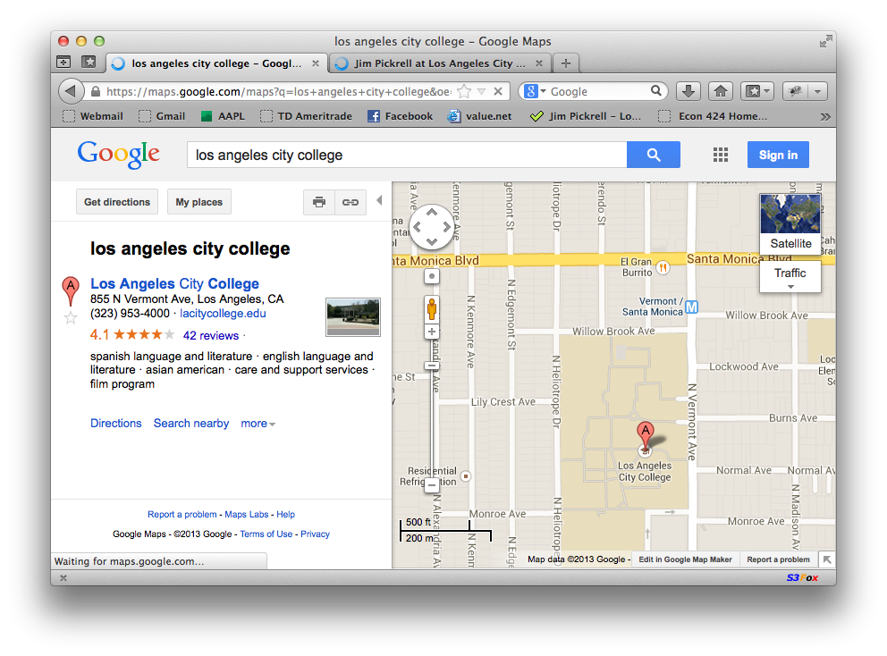
Let's do an example.
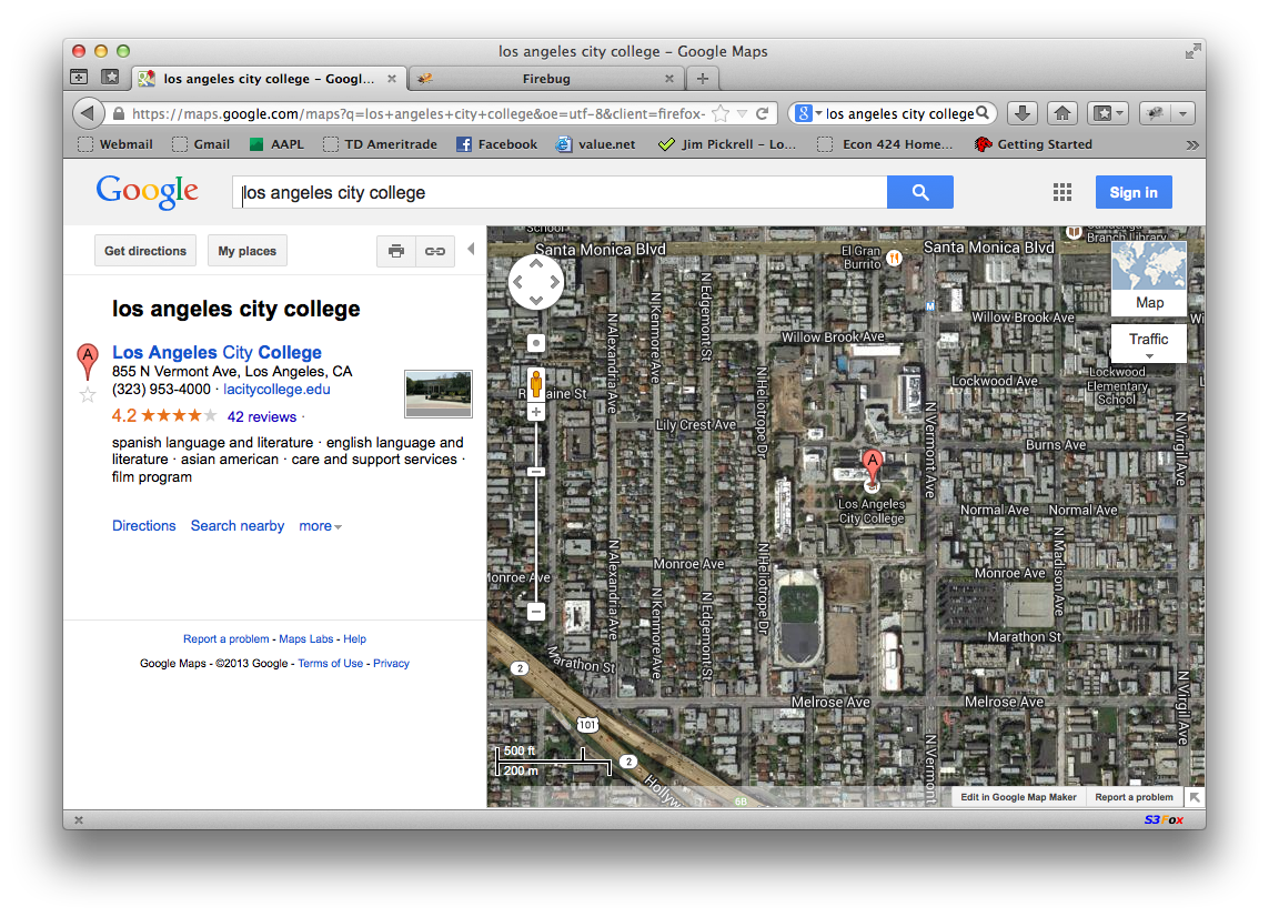
I will search for "Los Angeles City College" in Google.
Note that in order to do a map search, you should click on "maps" instead of search. Try it, you will see what I mean.
Here's what I got:.
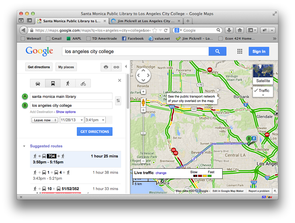
Let's get directions to the Santa Monica Library from Los Angeles City College.
Click the button for directions, then enter "Santa Monica Main Library" as the start point. Then hit "get directions".
Here's what we get:
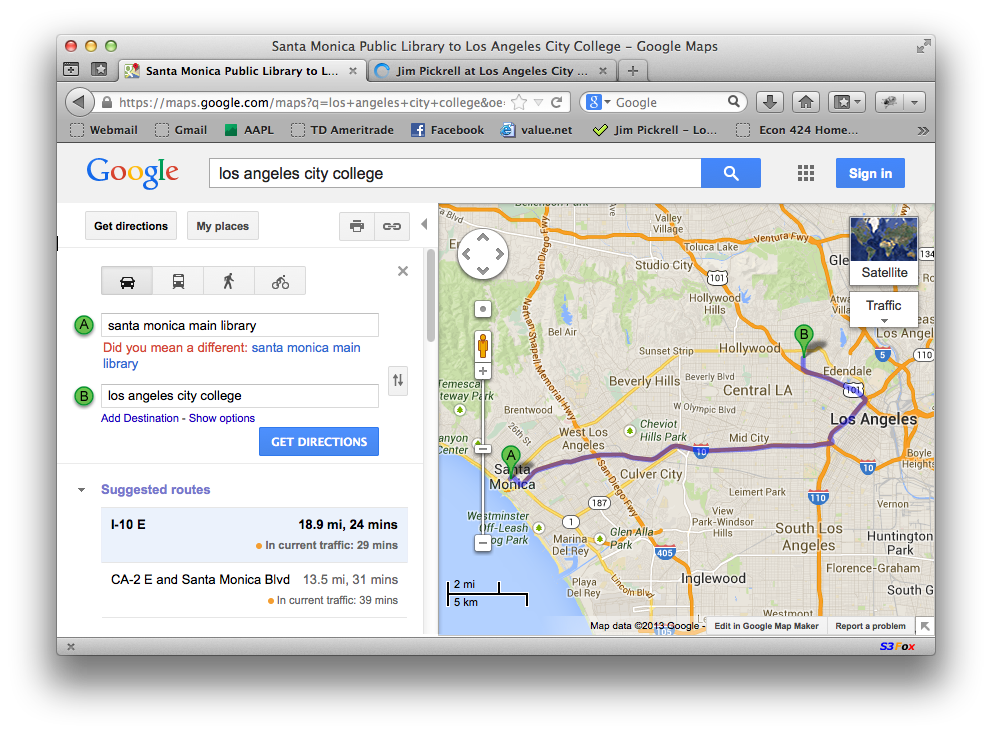
The map lists two routes. The first one is via I-10 E (the 10 freeway). We can see the alternate route by clicking on "CA-2 and Santa Monica Blvd". This will give us the "Route 66" path down Santa Monica Blvd. The distance and times for both routes are given.
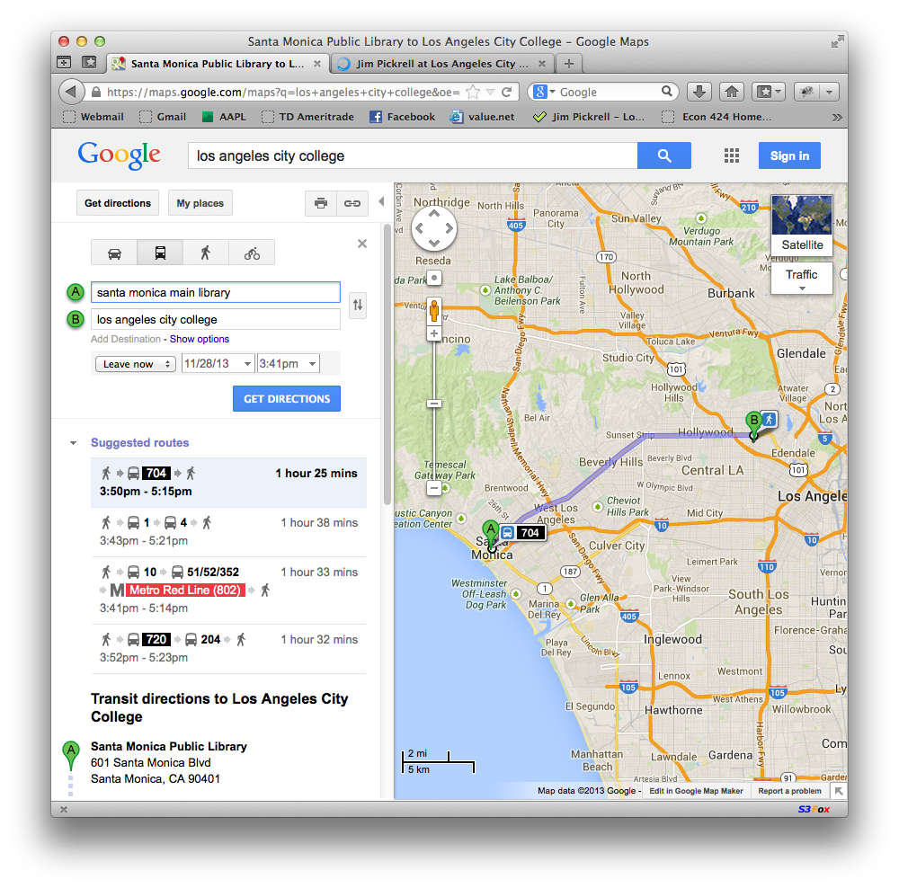
Let's see the bus route. Click on the bus icon (right above the start address) and you should see several bus routes. The results you get will depend on the day and time that you do the search, because Google actually consults the transit schedules.
If we click on the traffic icon (upper right of the screen) we can see the traffic map. Green paths are clear, red paths are slow, black means that this route is pretty much a parking lot.
Looks like there is some bad traffic right now in the general area around where the 405 and 101 freeways meet.
Let's switch to satelite view. If you click on that button, also in the upper right, the screen looks like this:
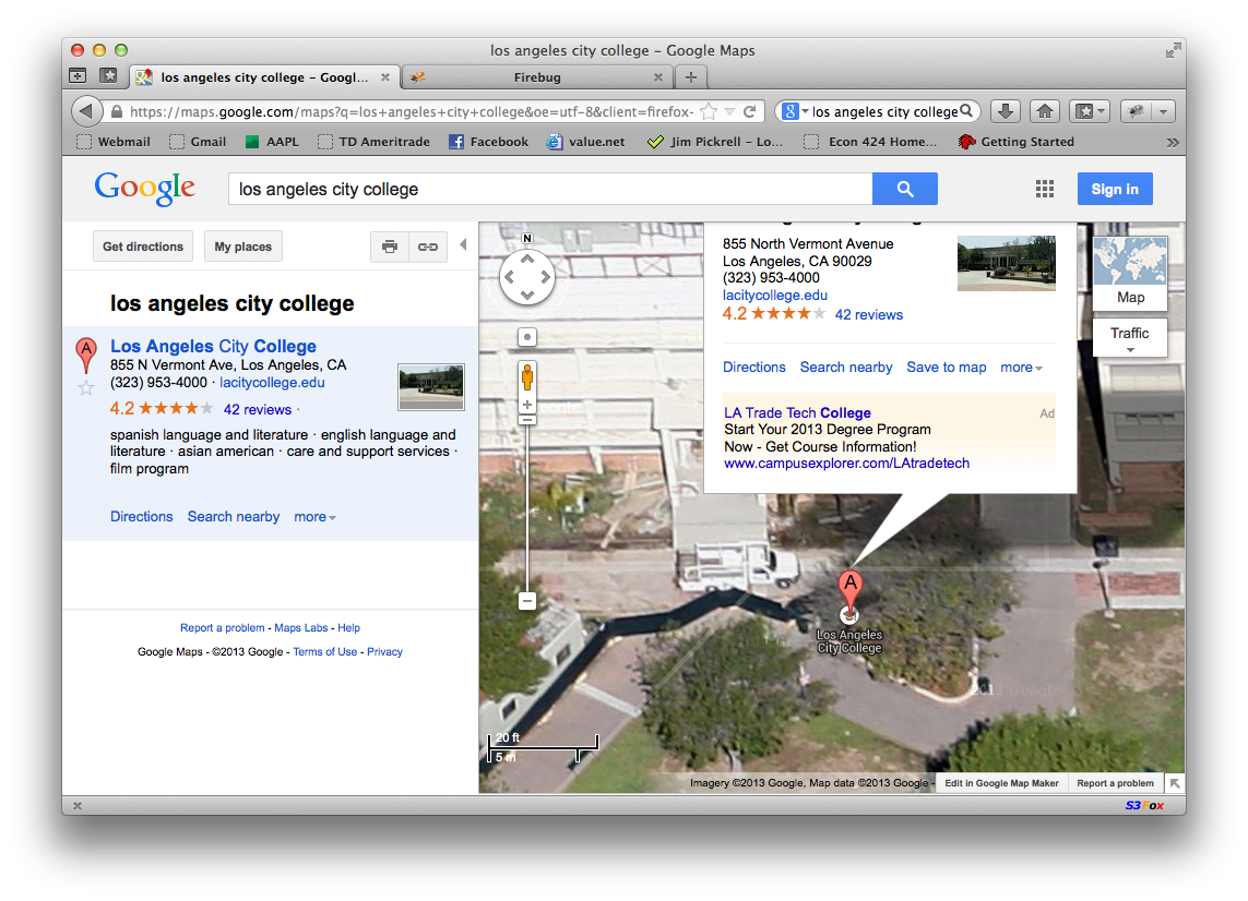
You can zoom in by clicking on the "+" button. Zoom out is "-". Here is a zoomed view of LACC:
If you zoom in all the way, or select street view, you will get a navigable mock 3d view like the following image, which shows a Gap store in Paris:
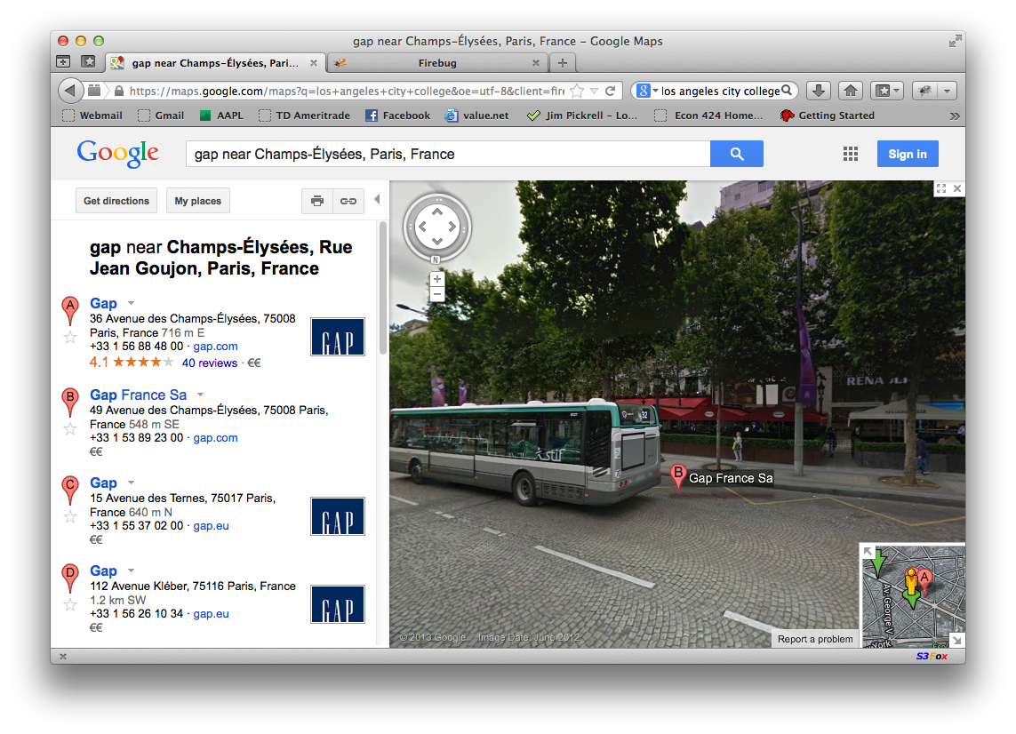
This is known as "street view".
Pretty amazing.
Google actually paid guys in trucks to drive around and take pictures of... almost everything.
Once you are in street view, you can navigate around, walking up and down the streets.
For example, let's find the Gap store on Champs Elysees in Paris, and let's walk up the stree to the famous Arc de Triomfe (sp?)
Just click on the arrows and you can walk up and down the street. Pretty cool.